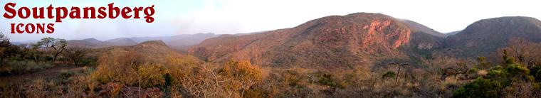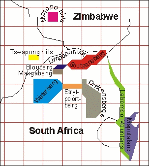
The Soutpansberg
is the northernmost mountain range of South Africa. The
Soutpansberg
topographical zone lies between 23° 05' S & 29° 17' E and 22°
25' S & 31° 20' E. From east to west, the Soutpansberg spans approximately
210 km, and from north to south it is 60 km at its widest and 15 km at
its narrowest. Its altitude ranges from 250 m above sea level to Hanglip
1719 m (second-highest peak) and Letjuma 1748 m (the highest peak) on
the western half of the mountain. However, Letjuma is not the highest
point in the area. About 40 km to the west of it lies another mountain
range, the Blouberg, with a maximum altitude of 2050 m. The Blouberg belongs
to the same geological system as the Soutpansberg, but they are referred
to as separate geographical entities.